 UFZ Spatial Data Catalogue
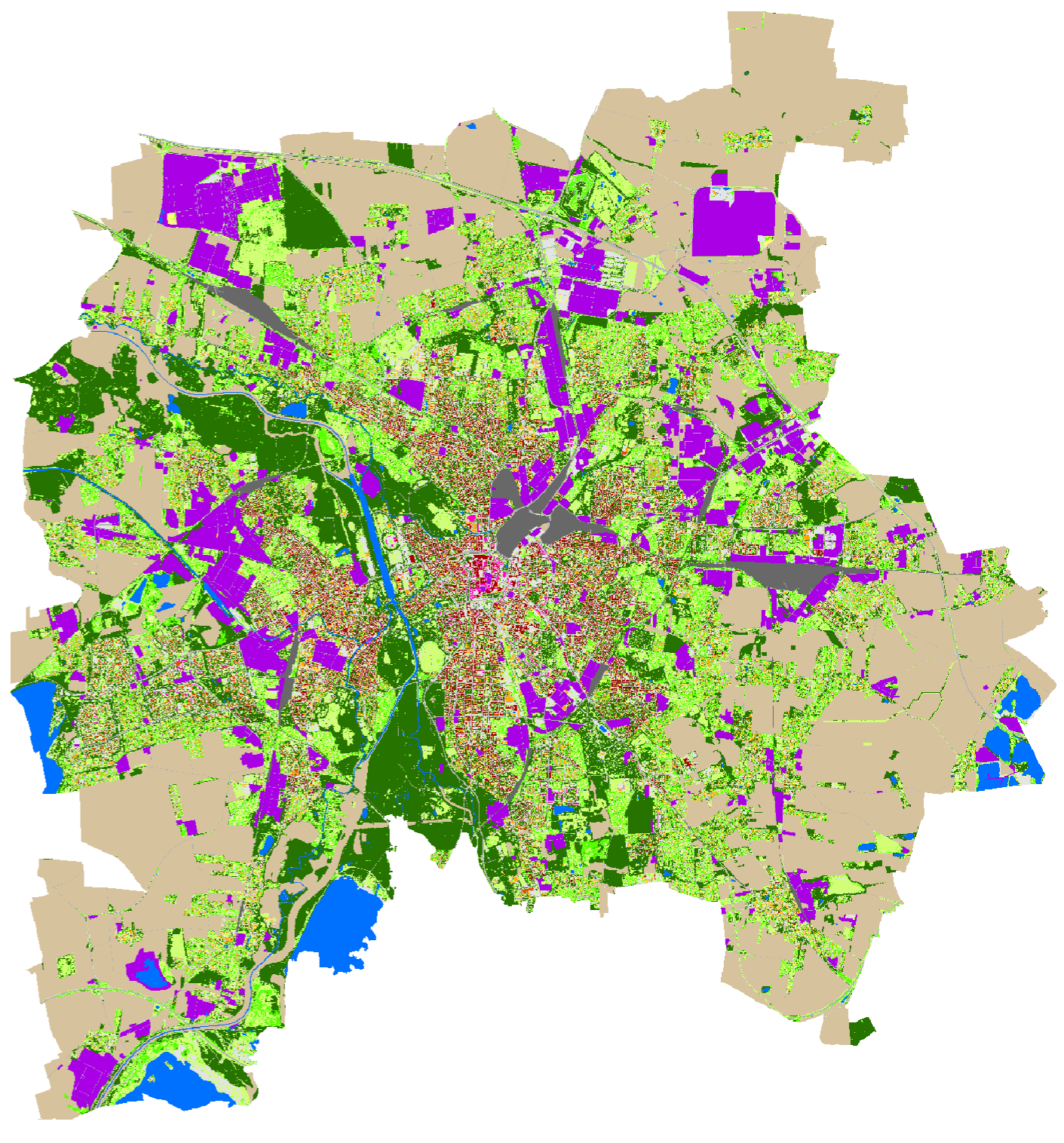
Fine-resolution land use/land cover classification of Leipzig in 2018
The dataset contains a land use/land cover (LULC) classification of Leipzig, Germany, for 2018. It is a follow-up on the dataset for 2012 https://doi.org/10.25870/1fv3-6e91, using the identical LULC classes. Find a class assignment and a QGIS-ready colormap file attached .
Simple
-
Date (Publication)
- 2026-06-18
-
Citation identifier
- urn:uuid/7e4da5b5-c506-45e8-b144-6b9ac3425d37
-
Title
-
Internal Identifier
-
-
Citation identifier
- doi/https://doi.org/10.25870/chba-j214
-
Title
-
DataCite
-
- Cited responsible party
-
Role Organisation Electronic mail address AuthorHelmholtz-Centre for Environmental Research UFZ
-
Status
-
Completed
-
Topic category
-
-
Environment
-
- Keywords
-
-
Leipzig
-
LULC
-
remote sensing
-
land use
-
land cover
-
OBIA
-
object based
-
Urban
-
ALKIS
-
Resource constraints
-
Access constraints
-
License
Extent
))
Temporal extent
-
Time period
- 2018-01-01 2018-12-31
Associated resource
-
Title
-
Elze, Sebastian (2026): Fine-resolution land use/land cover classification of Leipzig in 2012
-
Citation identifier
- https://doi.org/10.25870/1fv3-6e91
-
Website
-
Mapping urban structures is a vital prerequisite for urban planners to enhance their databases for liveable cities dedicated to sustainable development. Therefore, it is important to measure urban grey and green structures at the scale of local districts to understand the urban structure and residential needs for urban ecosystem services. Our detailed analysis is a follow-up on the 2012 dataset (https://doi.org/10.25870/1fv3-6e91) and distinguishes between the same LULC classes. For a comparison between 2012 and 2018 and further analysis, see the publication Elze, S. & Banzhaf, E. (2022): High-precision monitoring of urban structures to understand changes in multiple ecosystem services, https://doi.org/10.1016/j.ufug.2022.127616.
-
Association Type
-
Larger work citation
Digital transfer options
-
OnLine resource
-
Dataset Download
-
OnLine resource
-
WMS
Web Map Service.
-
Reference system identifier
- EPSG/EPSG:25833
-
Title
-
EPSG Geodetic Parameter Registry
-
Metadata
-
Metadata identifier
- urn:uuid/7e4da5b5-c506-45e8-b144-6b9ac3425d37
-
Language
- English
-
Character encoding
-
UTF8
- Contact
-
Role Organisation Electronic mail address Point of contactHelmholtz-Centre for Environmental Research UFZ
Type of resource
-
Resource type
-
Dataset
-
Metadata linkage
-
https://web.app.ufz.de/geonetwork/srv/api/records/7e4da5b5-c506-45e8-b144-6b9ac3425d37?language=all
-
Date info (Creation)
- 2026-06-18T12:18:41.738041Z
-
Date info (Revision)
- 2026-07-29T13:41:59.570711Z
Metadata standard
-
Title
-
ISO 19115-1 Geographic Information - Metadata
-
Edition
-
ISO 19115-1:2014 / Amd 1:2018
)))